
Carte topographique Douglas County
Carte interactive
Cliquez sur la carte pour afficher l’altitude.
Douglas County
According to the U.S. Census Bureau, the county has an area of 738 square miles (1,910 km2), of which 710 square miles (1,800 km2) is land and 28 square miles (73 km2) (3.8%) is water. It is the second-smallest county in Nevada by area. The highest point is East Peak at 9,593 ft (2,924 m), while the most topographically prominent mountain is Mount Siegel.
À propos de cette carte
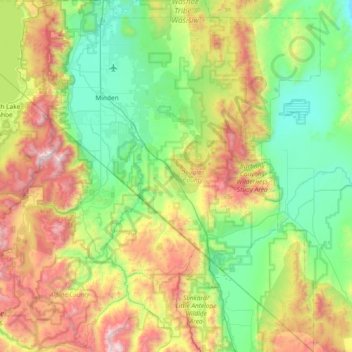
Nom : Carte topographique Douglas County, altitude, relief.
Lieu : Douglas County, Nevada, United States of America (38.53617 -120.00343 39.11401 -119.31548)
Altitude moyenne : 1 940 m
Altitude minimum : 1 345 m
Altitude maximum : 3 308 m