
Carte topographique Navy Island
Carte interactive
Cliquez sur la carte pour afficher l’altitude.
À propos de cette carte
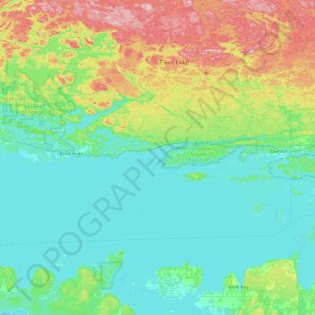
Nom : Carte topographique Navy Island, altitude, relief.
Altitude moyenne : 237 m
Altitude minimum : 172 m
Altitude maximum : 465 m
Autres cartes topographiques
Cliquez sur une carte pour visualiser sa topographie, son altitude et son relief.
The North Shore
Canada > Ontario > The North Shore
The North Shore, Algoma District, Northeastern Ontario, Ontario, Canada
Altitude moyenne : 212 m