
Carte topographique Rußbach am Paß Gschütt
Carte interactive
Cliquez sur la carte pour afficher l’altitude.
À propos de cette carte
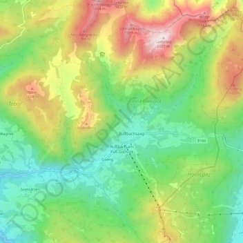
Nom : Carte topographique Rußbach am Paß Gschütt, altitude, relief.
Altitude moyenne : 1 173 m
Altitude minimum : 669 m
Altitude maximum : 2 017 m
Dörfer: Rußbach am Paß Gschütt • Strubegg | Weiler: Erlbach | Rotten: Bodenberg • Elendgraben • Gseng • Hornegg • Rußbachsaag • Rußegg • Schattau • Schattauhöhe • Triebenegg • Wiesenau | Häusergruppe: Scheiben