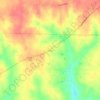
Carte topographique Cullman
Cliquez sur la carte pour afficher l’altitude.
Cullman
Cullman is located on top of the Brindley Mountain plateau at 34°10′39″N 86°50′42″W / 34.17750°N 86.84500°W / 34.17750; -86.84500 (34.177508, −86.844996). This is a close offshoot of the long geographic ridge called Sand Mountain, a southmost extension of the Appalachian Mountains. The elevation is 826 feet (252 m), close to the watershed between the Tennessee River and the Black Warrior River. Cullman provides its own town water supply from a city-owned lake within the city limits, Lake Catoma.
À propos de cette carte

Nom : Carte topographique Cullman, altitude, relief.
Lieu : Cullman, Cullman County, Alabama, United States (34.09015 -86.90025 34.25071 -86.77715)
Altitude moyenne : 239 m
Altitude minimum : 159 m
Altitude maximum : 321 m
Autres cartes topographiques
Cliquez sur une carte pour visualiser sa topographie, son altitude et son relief.