
Carte topographique Creston
Carte interactive
Cliquez sur la carte pour afficher l’altitude.
À propos de cette carte
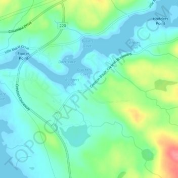
Nom : Carte topographique Creston, altitude, relief.
Altitude moyenne : 23 m
Altitude minimum : 0 m
Altitude maximum : 85 m
Autres cartes topographiques
Cliquez sur une carte pour visualiser sa topographie, son altitude et son relief.
Big Pond
Canada > Newfoundland and Labrador > Marystown
Big Pond, Marystown, Newfoundland, Newfoundland and Labrador, Canada
Altitude moyenne : 71 m