
Carte topographique LAS MARGARITAS
Carte interactive
Cliquez sur la carte pour afficher l’altitude.
À propos de cette carte
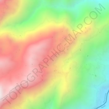
Nom : Carte topographique LAS MARGARITAS, altitude, relief.
Altitude moyenne : 1 503 m
Altitude minimum : 1 027 m
Altitude maximum : 1 909 m
Autres cartes topographiques
Cliquez sur une carte pour visualiser sa topographie, son altitude et son relief.
AGUABONITA
Colombia > Caldas > Manzanares
AGUABONITA, Manzanares, Alto Oriente, Caldas, RAP del Agua y la Montaña, Colombia
Altitude moyenne : 1 736 m