
Carte topographique Gaddesby
Carte interactive
Cliquez sur la carte pour afficher l’altitude.
À propos de cette carte
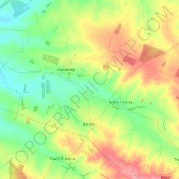
Nom : Carte topographique Gaddesby, altitude, relief.
Altitude moyenne : 105 m
Altitude minimum : 63 m
Altitude maximum : 155 m
Autres cartes topographiques
Cliquez sur une carte pour visualiser sa topographie, son altitude et son relief.
Melton Mowbray
United Kingdom > England > Leicestershire > Borough of Melton > Melton Mowbray
Melton Mowbray, Borough of Melton, Leicestershire, East Midlands, England, LE13 0TT, United Kingdom
Altitude moyenne : 103 m