
Carte topographique Xai-Xai
Carte interactive
Cliquez sur la carte pour afficher l’altitude.
À propos de cette carte
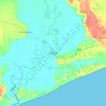
Nom : Carte topographique Xai-Xai, altitude, relief.
Lieu : Xai-Xai, Cidade de Xai-Xai, Gaza, Mozambique (-25.20448 33.48073 -24.88448 33.80073)
Altitude moyenne : 19 m
Altitude minimum : -4 m
Altitude maximum : 132 m
Xai-Xai is located close to the Indian Ocean, on the Limpopo River. It is 200 kilometres (120 mi) from the capital, Maputo, and is in a wide, fertile plain where rice is grown. It is at an elevation of 32 feet (9.8 m).