
Carte topographique Wohnstadt
Carte interactive
Cliquez sur la carte pour afficher l’altitude.
À propos de cette carte
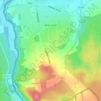
Nom : Carte topographique Wohnstadt, altitude, relief.
Lieu : Wohnstadt, Überherrn, Landkreis Saarlouis, Saarland, Deutschland (49.22134 6.69982 49.24137 6.72534)
Altitude moyenne : 231 m
Altitude minimum : 196 m
Altitude maximum : 286 m
Autres cartes topographiques
Cliquez sur une carte pour visualiser sa topographie, son altitude et son relief.
Berus
Deutschland > Saarland > Überherrn
Berus, Überherrn, Landkreis Saarlouis, Saarland, Deutschland
Altitude moyenne : 250 m