
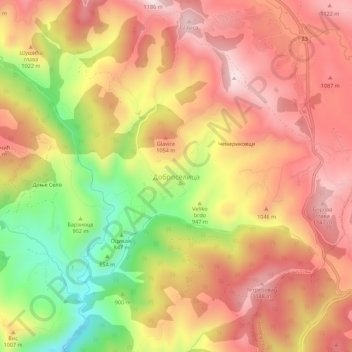
Carte topographique Доброселица
Carte interactive
Cliquez sur la carte pour afficher l’altitude.
À propos de cette carte
Nom : Carte topographique Доброселица, altitude, relief.
Altitude moyenne : 971 m
Altitude minimum : 677 m
Altitude maximum : 1 170 m
Autres cartes topographiques
Cliquez sur une carte pour visualiser sa topographie, son altitude et son relief.
Златибор
Serbie > Serbie centrale > Златиборски управни округ > Општина Чајетина
Златибор, Општина Чајетина, Златиборски управни округ, Serbie centrale, Serbie
Altitude moyenne : 1 218 m
Чајетина
Serbie > Serbie centrale > Златиборски управни округ > Општина Чајетина
Чајетина, Општина Чајетина, Златиборски управни округ, Serbie centrale, 31310, Serbie
Altitude moyenne : 888 m