
Carte topographique Koglhof
Carte interactive
Cliquez sur la carte pour afficher l’altitude.
À propos de cette carte
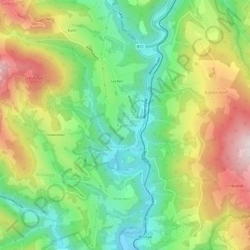
Nom : Carte topographique Koglhof, altitude, relief.
Lieu : Koglhof, Birkfeld, Bezirk Weiz, Styria, 8190, Austria (47.29866 15.66878 47.33866 15.70878)
Altitude moyenne : 716 m
Altitude minimum : 494 m
Altitude maximum : 1 038 m