Géolocaliser

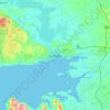
Carte topographique Barrow

Cliquez sur la carte pour afficher l’altitude.

À propos de cette carte

Nom : Carte topographique Barrow, altitude, relief.

Lieu : Barrow, Ireland (52.27679 -7.52818 53.18539 -6.91456)

Altitude moyenne : 135 m

Altitude minimum : -4 m

Altitude maximum : 912 m

Autres cartes topographiques

Cliquez sur une carte pour visualiser sa topographie, son altitude et son relief.

Cork

Ireland > County Cork > Cork

Altitude moyenne : 94 m

Kildare

Ireland > Kildare

Altitude moyenne : 102 m

Bray

Ireland > County Wicklow > Bray

Altitude moyenne : 58 m

Killarney

Ireland > County Kerry > Killarney

Altitude moyenne : 66 m

Galway City

Ireland > Galway City

Altitude moyenne : 26 m

Inis Meáin

Ireland > County Donegal

Altitude moyenne : 1 m

Limerick

Ireland > County Limerick > Limerick

Limerick's climate is classified as temperate oceanic (Köppen Cfb). Met Éireann maintains a climatological weather station at Shannon Airport, 20 kilometres west of the city in County Clare. Shannon Airport records an average of 977 millimetres of precipitation annually, most of which is rain. Limerick has a…

Altitude moyenne : 10 m

Ennis

Ireland > County Clare > Ennis

Altitude moyenne : 20 m

Great Skellig

Ireland

Altitude moyenne : 1 m

Drogheda

Ireland > County Louth > Drogheda

Altitude moyenne : 38 m

River Shannon

Ireland

Altitude moyenne : 39 m

Cromane

Ireland

Altitude moyenne : 3 m

Maghera Strand

Ireland

Altitude moyenne : 37 m

Knockdrin

Ireland

Altitude moyenne : 96 m

Ballycurry

Ireland

Altitude moyenne : 178 m

Ballyedmond

Ireland

Altitude moyenne : 73 m

Furry Glen

Ireland

Altitude moyenne : 44 m

Trout Lake

Ireland

Altitude moyenne : 81 m

Tory Hill

Ireland

Altitude moyenne : 131 m

Dowth

Ireland

Altitude moyenne : 32 m

Spinans Hill

Ireland

Altitude moyenne : 244 m

Gaulstown Castle

Ireland

Altitude moyenne : 181 m

Skeaghvasteen

Ireland

Altitude moyenne : 97 m

Tibberaghny Castle

Ireland

Altitude moyenne : 18 m

Myles Big Stone

Ireland

Altitude moyenne : 89 m

Kilkee Cliffs

Ireland

Altitude moyenne : 19 m

Dunlicky Point

Ireland

Altitude moyenne : 18 m

Doulus Head

Ireland

Altitude moyenne : 16 m

Bolus Head

Ireland

Altitude moyenne : 28 m

Galley Head

Ireland

Altitude moyenne : 3 m

Downeen Point

Ireland

Altitude moyenne : 11 m

Frower Point

Ireland

Altitude moyenne : 20 m

Knockadoon Head

Ireland

Altitude moyenne : 6 m

Mine Head

Ireland

Altitude moyenne : 22 m

Glendoo Mountain

Ireland

Altitude moyenne : 480 m

Crohy Head Sea Arch

Ireland

Altitude moyenne : 28 m

Dawros Bay

Ireland

Altitude moyenne : 6 m

Portacloy Bay

Ireland

Altitude moyenne : 57 m

Mace Head

Ireland

Altitude moyenne : 3 m

Doonbeg Head

Ireland

Altitude moyenne : 32 m

Lambs Head Bay

Ireland

Altitude moyenne : 14 m

Clifden Bay

Ireland

Altitude moyenne : 41 m

Galway Bay

Ireland

Altitude moyenne : 0 m

Dollymount

Ireland

Altitude moyenne : 6 m

Letterkenny

Ireland > County Donegal > Letterkenny

Altitude moyenne : 93 m

Athlone

Ireland > County Westmeath > Athlone

Altitude moyenne : 44 m

Midleton

Ireland > Midleton

Altitude moyenne : 42 m

Djouce

Ireland > County Wicklow

Altitude moyenne : 534 m

Lugduff

Ireland > County Wicklow

Altitude moyenne : 458 m

Tynagh

Ireland > County Galway

Altitude moyenne : 65 m

Tolka Valley Park

Ireland > County Dublin > Dublin

Altitude moyenne : 44 m

Foyleatalure

Ireland > County Kilkenny

Altitude moyenne : 216 m

Bray Head

Ireland > County Wicklow

Altitude moyenne : 44 m

Hill of Slane

Ireland > County Meath

Altitude moyenne : 88 m

Cliffs of Moher

Ireland > County Clare

Altitude moyenne : 55 m

Gallows hill

Ireland > County Wicklow

Altitude moyenne : 46 m

Lough Lilly

Ireland > County Donegal

Altitude moyenne : 225 m

Dungloe River

Ireland > County Donegal

Altitude moyenne : 24 m

Streamstown

Ireland > County Westmeath

Altitude moyenne : 105 m

Turlough Hill Reservoir

Ireland > County Wicklow

Altitude moyenne : 556 m

Rossaveel

Ireland > County Galway

Altitude moyenne : 14 m

Forth Mountain

Ireland > County Wexford

Altitude moyenne : 154 m

Robinstown

Ireland > County Meath

Altitude moyenne : 85 m

Lough Fea

Ireland > County Monaghan

Altitude moyenne : 50 m

Bartlemy

Ireland > County Cork

Altitude moyenne : 98 m

Malin Head

Ireland > County Donegal

Altitude moyenne : 4 m

Derg

Ireland > County Donegal

Altitude moyenne : 166 m

Trim Castle Keep

Ireland > County Meath > Trim

Altitude moyenne : 62 m

Carlow

Ireland > Carlow

Altitude moyenne : 63 m

Naas

Ireland > Naas

Altitude moyenne : 102 m

Dundalk

Ireland > County Louth > Dundalk

Altitude moyenne : 16 m

Clonmel

Ireland > County Tipperary > Clonmel

Altitude moyenne : 106 m

Dungarvan

Ireland > County Waterford

Altitude moyenne : 30 m

Mullingar

Ireland > County Westmeath

Altitude moyenne : 101 m

Swords

Ireland > County Dublin > Swords

The medieval town developed in a linear pattern along Main Street, in a roughly north-south direction. Swords has one of the best examples of this settlement pattern in the Dublin region. The round tower, 26m in height, is also an indicator of early Christian settlement. The Irish high king Brian Boru is said…

Altitude moyenne : 28 m

Mallow

Ireland > County Cork > Mallow

Altitude moyenne : 106 m

Clonakilty

Ireland > Clonakilty

Altitude moyenne : 49 m

Balbriggan

Ireland > County Dublin > Balbriggan

Altitude moyenne : 25 m

Greystones

Ireland > County Wicklow

Greystones is located south of the site of an ancient castle of the Barony of Rathdown. There was a hamlet which, like Rathdown Castle, was known as Rathdown, and which appeared on a 1712 map. This site occupied an area now known as the Grove, north of Greystones harbour, but only the ruins of a chapel, St.…

Altitude moyenne : 49 m

Tramore

Ireland > Tramore

Altitude moyenne : 30 m

Limerick

Ireland > Limerick

Limerick's climate is classified as temperate oceanic (Köppen Cfb). Met Éireann maintains a climatological weather station at Shannon Airport, 20 kilometres west of the city in County Clare. Shannon Airport records an average of 977 millimetres of precipitation annually, most of which is rain. Limerick has a…

Altitude moyenne : 54 m

Bailieborough

Ireland > County Cavan > Bailieborough

Altitude moyenne : 169 m

Celbridge

Ireland > County Kildare > Celbridge

Altitude moyenne : 64 m

Blackrock

Ireland > County Dublin

Altitude moyenne : 30 m

Killinick

Ireland > County Wexford

Altitude moyenne : 12 m

Blessington

Ireland > County Wicklow > Blessington

Altitude moyenne : 223 m

Dundrum

Ireland > County Dublin

Altitude moyenne : 79 m

Enniskerry

Ireland > County Wicklow > Enniskerry

Altitude moyenne : 118 m

Howth

Ireland > County Dublin

Altitude moyenne : 8 m

Kingscourt

Ireland > Kingscourt

Altitude moyenne : 104 m

Lucan

Ireland > County Dublin

Altitude moyenne : 59 m

Malahide

Ireland > County Dublin > Malahide

Altitude moyenne : 10 m

Maynooth

Ireland > County Kildare > Maynooth

Altitude moyenne : 66 m

Millstreet

Ireland > County Cork > Millstreet

Altitude moyenne : 170 m

Rush

Ireland > County Dublin > Rush

Altitude moyenne : 11 m

Skerries

Ireland > County Dublin > Skerries

Altitude moyenne : 16 m

Stepaside

Ireland > County Dublin

Altitude moyenne : 183 m

Waterford

Ireland > Waterford

Altitude moyenne : 57 m

Équipez-vous pour votre prochaine aventure :

🥤Gourdes de randonnée - Gourdes légères pour hydratation en marche
⌚Montre Altimètre Baromètre - Capteurs ABC pour suivre l'élévation et la météo en temps réel
🥤Sac d'Hydratation Trail - Système de boisson intégré pour un accès rapide sans s'arrêter
📱Supports smartphone randonnée - Fixations pratiques pour navigation mobile
📚Guide de Survie en Nature - Apprenez les techniques essentielles de bushcraft

En tant que Partenaire Amazon, ce site perçoit une commission sur les achats éligibles sans surcoût pour vous.