
Carte topographique Dorbod Banner
Carte interactive
Cliquez sur la carte pour afficher l’altitude.
Dorbod Banner
The banner is located along the northern foothills of the Yin Mountains, and has an average elevation of 1,400 metres (4,600 ft).[3] Most of the banner's area is grassland.[3]
À propos de cette carte
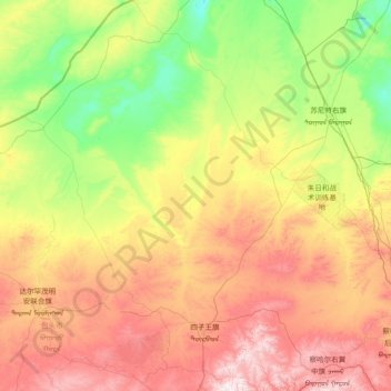
Nom : Carte topographique Dorbod Banner, altitude, relief.
Lieu : Dorbod Banner, Ulanqab City, Inner Mongolia, China (41.19250 110.33398 43.37933 112.99498)
Altitude moyenne : 1 294 m
Altitude minimum : 926 m
Altitude maximum : 2 165 m
Autres cartes topographiques
Cliquez sur une carte pour visualiser sa topographie, son altitude et son relief.