
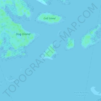
Carte topographique One Tree Island
Carte interactive
Cliquez sur la carte pour afficher l’altitude.
À propos de cette carte
Nom : Carte topographique One Tree Island, altitude, relief.
Altitude moyenne : 0 m
Altitude minimum : -5 m
Altitude maximum : 5 m
Autres cartes topographiques
Cliquez sur une carte pour visualiser sa topographie, son altitude et son relief.
Riddells Creek
Riddells Creek, Shire of Macedon Ranges, Victoria, 3431, Australia
Altitude moyenne : 436 m
Wingan River
Wingan River, Shire of East Gippsland, Victoria, 3891, Australia
Altitude moyenne : 101 m
Yarra Glen
Australia > Victoria > Melbourne
Yarra Glen, Melbourne, Shire of Yarra Ranges, Victoria, 3775, Australia
Altitude moyenne : 128 m
Mount Bogong
Mount Bogong, Alpine Shire, Hume, Victoria, Australia
Altitude moyenne : 1 719 m
Healesville
Australia > Victoria > Healesville
Healesville, Shire of Yarra Ranges, Victoria, 3777, Australia
Altitude moyenne : 150 m
City of Greater Dandenong
City of Greater Dandenong, Victoria, Australia
Altitude moyenne : 33 m
Manifold Heights
Australia > Victoria > Geelong
Manifold Heights, Geelong, City of Greater Geelong, Barwon South West, Victoria, 3218, Australia
Altitude moyenne : 41 m
Basalt Lake
Australia > Victoria > Harkaway
Basalt Lake, Board Walk, Berwick, Harkaway, City of Casey, Victoria, 3806, Australia
Altitude moyenne : 76 m
Mount Strickland
Mount Strickland, Shire of Murrindindi, Hume, Victoria, Australia
Altitude moyenne : 868 m
Wilsons Promontory
Wilsons Promontory, Shire of South Gippsland, Victoria, 3960, Australia
Altitude moyenne : 38 m
Melbourne City
Melbourne City, City of Melbourne, Victoria, Australia
Altitude moyenne : 20 m
Surrey Hills
Surrey Hills, City of Boroondara, Victoria, Australia
Altitude moyenne : 96 m
Badger Creek
Australia > Victoria > Healesville
Badger Creek, Healesville, Shire of Yarra Ranges, Victoria, Australia
Altitude moyenne : 255 m
Lara District
Australia > Victoria > Geelong
Lara District, Shearers Lane, Lara, Geelong, City of Greater Geelong, Barwon South West, Victoria, 3212, Australia
Altitude moyenne : 94 m
Croajingolong National Park
Croajingolong National Park, Lake Barracotta Link Track, Genoa, Shire of East Gippsland, Gippsland, Victoria, Australia
Altitude moyenne : 50 m
Wilsons Promontory National Park
Wilsons Promontory National Park, Vereker Outlook, Wilsons Promontory, Shire of South Gippsland, Gippsland, Victoria, Australia
Altitude moyenne : 32 m
Hattah - Kulkyne National Park
Australia > Victoria > Colignan
Hattah - Kulkyne National Park, Reed Road, Hattah, Colignan, Rural City of Mildura, Loddon Mallee, Victoria, Australia
Altitude moyenne : 51 m