
Carte topographique Toungup Township
Carte interactive
Cliquez sur la carte pour afficher l’altitude.
À propos de cette carte
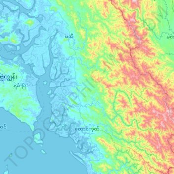
Nom : Carte topographique Toungup Township, altitude, relief.
Lieu : Toungup Township, Thandwe District, Rakhine, Myanmar (18.62185 93.99455 19.53834 94.76197)
Altitude moyenne : 229 m
Altitude minimum : -6 m
Altitude maximum : 1 458 m