
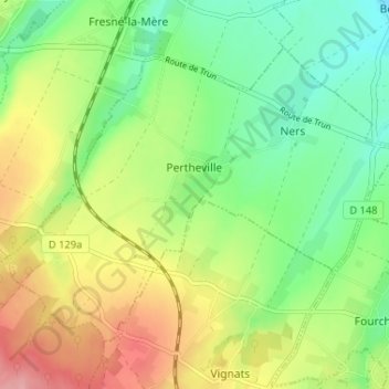
Carte topographique Pertheville-Ners
Carte interactive
Cliquez sur la carte pour afficher l’altitude.
À propos de cette carte
Nom : Carte topographique Pertheville-Ners, altitude, relief.
Altitude moyenne : 107 m
Altitude minimum : 59 m
Altitude maximum : 177 m
Autres cartes topographiques
Cliquez sur une carte pour visualiser sa topographie, son altitude et son relief.
La Balanderie
France > Normandie > Pertheville-Ners
La Balanderie, Pertheville-Ners, Caen, Calvados, Normandie, France métropolitaine, 14700, France
Altitude moyenne : 142 m