
Carte topographique Chatsworth
Carte interactive
Cliquez sur la carte pour afficher l’altitude.
À propos de cette carte
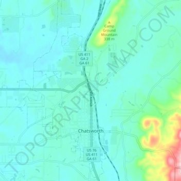
Nom : Carte topographique Chatsworth, altitude, relief.
Lieu : Chatsworth, Murray County, Georgia, United States (34.74681 -84.82888 34.81781 -84.76255)
Altitude moyenne : 241 m
Altitude minimum : 203 m
Altitude maximum : 460 m
Chatsworth is located in central Murray County at 34°46′20″N 84°46′44″W / 34.77222°N 84.77889°W / 34.77222; -84.77889 (34.772336, -84.778977), in northwestern Georgia. It sits at an elevation of 750 feet (230 m) on the west side of the valley of Holly Creek, with 2,840-foot (870 m) Fort Mountain and 2,780-foot (850 m) Cohutta Mountain rising over the valley to the east.