
Carte topographique Laverton
Carte interactive
Cliquez sur la carte pour afficher l’altitude.
À propos de cette carte
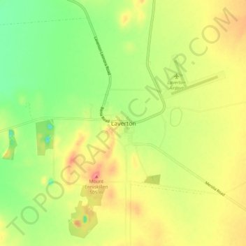
Nom : Carte topographique Laverton, altitude, relief.
Lieu : Laverton, Western Australia, 6440, Australia (-28.66631 122.36338 -28.58631 122.44338)
Altitude moyenne : 461 m
Altitude minimum : 423 m
Altitude maximum : 500 m
Laverton, originally known as British Flag, is a town in the Goldfields-Esperance region of Western Australia, and the centre of administration for the Shire of Laverton. The town of Laverton is located at the western edge of the Great Victoria Desert, 957 kilometres (595 mi) north-northeast of the state capital, Perth, and 124 kilometres (77 mi) east-northeast of the town of Leonora with an elevation of 461 m.
Autres cartes topographiques
Cliquez sur une carte pour visualiser sa topographie, son altitude et son relief.
Wongatha Wonganara
Australia > Western Australia > Laverton > Wongatha Wonganara
Wongatha Wonganara, Laverton, Western Australia, 6440, Australia
Altitude moyenne : 458 m