
Carte topographique Sierra de Guadarrama
Carte interactive
Cliquez sur la carte pour afficher l’altitude.
À propos de cette carte
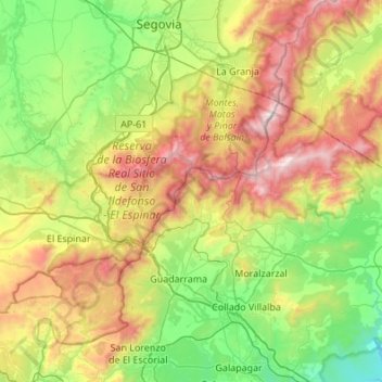
Nom : Carte topographique Sierra de Guadarrama, altitude, relief.
Altitude moyenne : 1 241 m
Altitude minimum : 640 m
Altitude maximum : 2 421 m
The range runs southwest–northeast, extending from the province of Ávila in the southwest, through the Community of Madrid, to the province of Segovia in the northeast. The range measures approximately 80 kilometres (50 mi) in length. Its highest peak is Peñalara, 2,428 metres (7,966 ft) in elevation.