
Carte topographique Jagdevpur
Cliquez sur la carte pour afficher l’altitude.
Jagdevpur
Located at 17°46′05″N 78°48′29″E / 17.768°N 78.808°E / 17.768; 78.808, Jagadevpur has an average elevation of 568 metres (1,864 ft). It is the fourth-largest mandal of the Siddipet district. Jagadevpur is 70 km north of Hyderabad and 30 km each from Bhongir and the famous Yadagirigutta (Temple).
À propos de cette carte
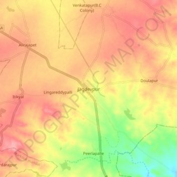
Nom : Carte topographique Jagdevpur, altitude, relief.
Altitude moyenne : 546 m
Altitude minimum : 484 m
Altitude maximum : 583 m