
Carte topographique Mt. Yamato-Katsuragi
Carte interactive
Cliquez sur la carte pour afficher l’altitude.
À propos de cette carte
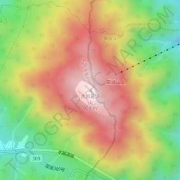
Nom : Carte topographique Mt. Yamato-Katsuragi, altitude, relief.
Altitude moyenne : 653 m
Altitude minimum : 344 m
Altitude maximum : 952 m
Mount Yamato Katsuragi (大和葛城山, Yamato Katsuragi-san) or simply Mount Katsuragi is a mountain in the Kongō Range straddling the prefectural border between Chihayaakasaka, Osaka and Gose, Nara in Japan. The peak elevation is 959.2 metres (3,147 ft). The mountain is located along the Gose Line of the Kintetsu Railway.