
Carte topographique Ashland
Carte interactive
Cliquez sur la carte pour afficher l’altitude.
À propos de cette carte
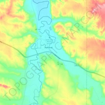
Nom : Carte topographique Ashland, altitude, relief.
Altitude moyenne : 940 m
Altitude minimum : 879 m
Altitude maximum : 1 039 m
The area offers a variety of topography, varying from rolling grasslands to steep rock outcrops. Vegetation varies from prairie to dense stands of ponderosa pine.