
Carte topographique Zernez
Carte interactive
Cliquez sur la carte pour afficher l’altitude.
À propos de cette carte
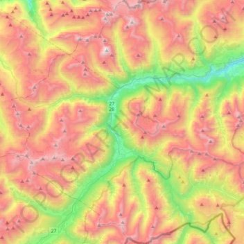
Nom : Carte topographique Zernez, altitude, relief.
Altitude moyenne : 2 297 m
Altitude minimum : 1 199 m
Altitude maximum : 3 366 m
Lai da Ova Spin is a compensation reservoir on the river Spöl. It is located in the upper areas of the Lower Engadine valley (Romansh: Engiadina Bassa). It is located at an elevation of 1,473 m (4,833 ft) and is connected to the railway network of the Rhätische Bahn. In Zernez, the stream Spöl empties into the Inn (Romansh: En).
Autres cartes topographiques
Cliquez sur une carte pour visualiser sa topographie, son altitude et son relief.
Swiss National Park
Switzerland > Grisons > Zernez
Swiss National Park, 28, Punt la Drossa, Zernez, Region Engiadina Bassa/Val Müstair, Grisons, 7530, Switzerland
Altitude moyenne : 2 283 m