
Carte topographique Drumadown
Carte interactive
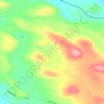
Cliquez sur la carte pour afficher l’altitude.
À propos de cette carte
Nom : Carte topographique Drumadown, altitude, relief.
Altitude moyenne : 110 m
Altitude minimum : 45 m
Altitude maximum : 184 m
Autres cartes topographiques
Cliquez sur une carte pour visualiser sa topographie, son altitude et son relief.
Aghakeeran
Royaume-Uni > Irlande du Nord > Derrygonnelly
Aghakeeran, Old Barr ED, Derrygonnelly, County Fermanagh, Irlande du Nord, Royaume-Uni
Altitude moyenne : 124 m
Drumary
Royaume-Uni > Irlande du Nord > Derrygonnelly
Drumary, Doagh ED, Derrygonnelly, County Fermanagh, Irlande du Nord, Royaume-Uni
Altitude moyenne : 74 m