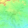
Carte topographique Ranchi
Cliquez sur la carte pour afficher l’altitude.
Ranchi
Ranchi has a humid subtropical climate. However, due to its position and the forests around the city, it is known for its pleasant climate. Its climate is the primary reason why Ranchi was once the summer capital of the undivided State of Bihar. Ranchi used to be a preferable hill station in the past. Temperature ranges from maximum 42 to 20 °C during summer, and from 25 to 0 °C during winter. December and January are the coolest months with temperature getting to freezing point in some places of the city. The annual rainfall is about 1430 mm (56.34 inches). From June to September the rainfall is about 1,100 mm. Ranchi is located at 23°21′N 85°20′E.[5] The total area covered by the Ranchi municipal area is 175.12 square kilometres and the average elevation of the city is 651 m above sea level.
À propos de cette carte
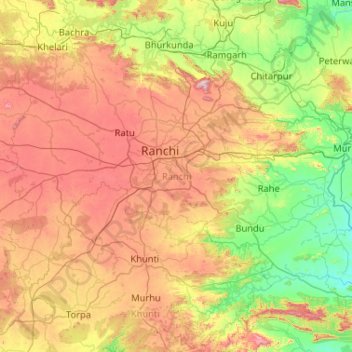
Nom : Carte topographique Ranchi, altitude, relief.
Lieu : Ranchi, Jharkhand, India (22.88345 84.86544 23.71749 85.90279)
Altitude moyenne : 493 m
Altitude minimum : 189 m
Altitude maximum : 1 034 m
Autres cartes topographiques
Cliquez sur une carte pour visualiser sa topographie, son altitude et son relief.

Dhanbad
India > Jharkhand > Dhanbad-Cum-Kenduadih-Cum-Jagata
Dhanbad has an average elevation of 227 m (745 ft). Its geographical length (extending from north to south) is 15 miles (24 km) and the breadth (stretching across east to West) is 10 miles (16 km). It shares its boundaries with West Bengal in the eastern and southern part, Giridih and Dumka in the North and…
Altitude moyenne : 212 m