
Carte topographique Dębica
Carte interactive
Cliquez sur la carte pour afficher l’altitude.
À propos de cette carte
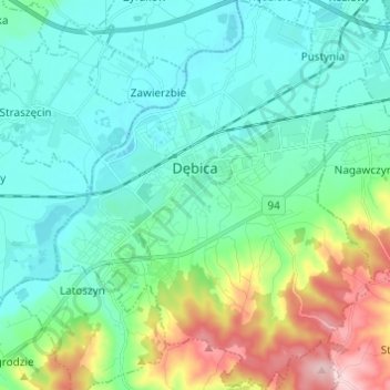
Nom : Carte topographique Dębica, altitude, relief.
Altitude moyenne : 233 m
Altitude minimum : 180 m
Altitude maximum : 406 m
Autres cartes topographiques
Cliquez sur une carte pour visualiser sa topographie, son altitude et son relief.
Podkościele
Poland > Subcarpathian Voivodeship > Dębica County > Łęki Górne
Podkościele, Łęki Górne, gmina Pilzno, Dębica County, Subcarpathian Voivodeship, 39-221, Poland
Altitude moyenne : 254 m
Dębica
Poland > Subcarpathian Voivodeship > Dębica County > Dębica
Dębica, Dębica County, Subcarpathian Voivodeship, 39-200, Poland
Altitude moyenne : 234 m