
Faire un don
Équipez-vous pour votre prochaine aventure :
En tant que Partenaire Amazon, ce site perçoit une commission sur les achats éligibles sans surcoût pour vous.
Carte topographique Dayi County
Cliquez sur la carte pour afficher l’altitude.
Faire un don
Équipez-vous pour votre prochaine aventure :
En tant que Partenaire Amazon, ce site perçoit une commission sur les achats éligibles sans surcoût pour vous.
À propos de cette carte
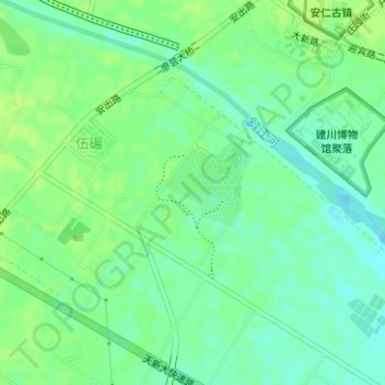
Nom : Carte topographique Dayi County, altitude, relief.
Lieu : Dayi County, Chengdu, Sichuan, China (30.49637 103.60373 30.50115 103.60977)
Altitude moyenne : 498 m
Altitude minimum : 490 m
Altitude maximum : 504 m
Faire un don
Équipez-vous pour votre prochaine aventure :
En tant que Partenaire Amazon, ce site perçoit une commission sur les achats éligibles sans surcoût pour vous.
Autres cartes topographiques
Cliquez sur une carte pour visualiser sa topographie, son altitude et son relief.
Jiuzhaigou
China > Sichuan > Jiuzhaigou County
The county consists of nine villages in a valley in Sichuan Province. The main ethnic group in the county is Han, with the second being Tibetan. The county seat has an altitude of about 1,400 m (4,600 ft).[1] It has a total area of 2,041 square miles (5,286 km2).[2] As of 2015, the county's total population…
Altitude moyenne : 2 520 m
Mount Emei
China > Sichuan > Emeishan City > Emeishan
The flora of Mount Emei varies with elevation, from subtropical evergreen forests at lower elevations to subalpine shrubland around the summit. The mountain is notable for both its species richness and abundance of endemic plants.
Altitude moyenne : 2 434 m
Faire un don
Équipez-vous pour votre prochaine aventure :
En tant que Partenaire Amazon, ce site perçoit une commission sur les achats éligibles sans surcoût pour vous.
Pidu District
It is now seeking to attract electronics and IT corporations and, in 2015, applied for elevation to urban district status.
Altitude moyenne : 562 m
Lugu Lake
China > Sichuan > Yanyuan County > Mukua
Lugu Lake (simplified Chinese: 泸沽湖; traditional Chinese: 瀘沽湖; pinyin: Lúgū Hú) is located in the northwest of the Yunnan plateau, with the middle of the lake forming the border between the Ninglang County of Yunnan Province and the Yanyuan County of Sichuan Province. The formation of the lake is…
Altitude moyenne : 2 750 m
Faire un don
Équipez-vous pour votre prochaine aventure :
En tant que Partenaire Amazon, ce site perçoit une commission sur les achats éligibles sans surcoût pour vous.
Jiuzhaigou County
The county consists of nine villages in a valley in Sichuan Province. The main ethnic group in the county is Han, with the second being Tibetan. The county seat has an altitude of about 1,400 m (4,600 ft). It has a total area of 2,041 square miles (5,286 km2). As of 2015, the county's total population was…
Altitude moyenne : 3 201 m
Faire un don
Équipez-vous pour votre prochaine aventure :
En tant que Partenaire Amazon, ce site perçoit une commission sur les achats éligibles sans surcoût pour vous.
Faire un don
Équipez-vous pour votre prochaine aventure :
En tant que Partenaire Amazon, ce site perçoit une commission sur les achats éligibles sans surcoût pour vous.
Faire un don
Équipez-vous pour votre prochaine aventure :
En tant que Partenaire Amazon, ce site perçoit une commission sur les achats éligibles sans surcoût pour vous.
Sêrxü County
Sêrxü (sershul) County is situated at the northwest corner of Sichuan province, and is also the westernmost county-level division of the province. Its area is approximately 25,000 km2, mainly covered by grasslands. The average elevation is 4,200 m above sea level.
Altitude moyenne : 4 491 m
Litang County
Litang County (Tibetan: ལི་ཐང་རྫོང་།; Chinese: 理塘县) is southwest of Garzê Tibetan Autonomous Prefecture, in Sichuan, China, in the traditional Tibetan region of Kham. It contains 7 towns and a population of more than 60,000 in 2020. Due to its elevation and mountainous terrain,…
Altitude moyenne : 4 217 m
Faire un don
Équipez-vous pour votre prochaine aventure :
En tant que Partenaire Amazon, ce site perçoit une commission sur les achats éligibles sans surcoût pour vous.
Litang County
Litang County (Tibetan: ལི་ཐང་རྫོང་།; Chinese: 理塘县) is southwest of Garzê Tibetan Autonomous Prefecture, in Sichuan, China, in the traditional Tibetan region of Kham. It contains 7 towns and a population of more than 60,000 in 2020. Due to its elevation and mountainous terrain,…
Altitude moyenne : 4 217 m
Kangding
Kangding has a monsoon-influenced climate, lying in the transition between a humid continental (Dwb) and a subtropical highland climate (Cwb) on the Köppen system. Despite the elevation of 2,560 metres (8,400 ft), the diurnal temperature variation averages at most 10.6 °C (19.1 °F) in any month. From April…
Altitude moyenne : 3 331 m
Faire un don
Équipez-vous pour votre prochaine aventure :
En tant que Partenaire Amazon, ce site perçoit une commission sur les achats éligibles sans surcoût pour vous.
Tagong
A gompa is where the Tagong Monastery is located. The gompa is one of the most important in the in Tibetan Pel Lhagong. The Tagong Monastery was established with reference to a nearby sacred mountain, Mt. Yala or Zhara Lhaste, which is 5,820 metres (19,090 ft) in elevation.
Altitude moyenne : 3 874 m
Faire un don
Équipez-vous pour votre prochaine aventure :
En tant que Partenaire Amazon, ce site perçoit une commission sur les achats éligibles sans surcoût pour vous.
Faire un don
Équipez-vous pour votre prochaine aventure :
En tant que Partenaire Amazon, ce site perçoit une commission sur les achats éligibles sans surcoût pour vous.
Kangding
Kangding has a monsoon-influenced climate, lying in the transition between a humid continental (Dwb) and a subtropical highland climate (Cwb) on the Köppen system. Despite the elevation of 2,560 metres (8,400 ft), the diurnal temperature variation averages at most 10.6 °C (19.1 °F) in any month. From April…
Altitude moyenne : 3 331 m
Faire un don
Équipez-vous pour votre prochaine aventure :
En tant que Partenaire Amazon, ce site perçoit une commission sur les achats éligibles sans surcoût pour vous.
Faire un don
Équipez-vous pour votre prochaine aventure :
En tant que Partenaire Amazon, ce site perçoit une commission sur les achats éligibles sans surcoût pour vous.
Faire un don
Équipez-vous pour votre prochaine aventure :
En tant que Partenaire Amazon, ce site perçoit une commission sur les achats éligibles sans surcoût pour vous.
Faire un don
Équipez-vous pour votre prochaine aventure :
En tant que Partenaire Amazon, ce site perçoit une commission sur les achats éligibles sans surcoût pour vous.
Faire un don
Équipez-vous pour votre prochaine aventure :
En tant que Partenaire Amazon, ce site perçoit une commission sur les achats éligibles sans surcoût pour vous.
Faire un don
Équipez-vous pour votre prochaine aventure :
En tant que Partenaire Amazon, ce site perçoit une commission sur les achats éligibles sans surcoût pour vous.
Faire un don
Équipez-vous pour votre prochaine aventure :
En tant que Partenaire Amazon, ce site perçoit une commission sur les achats éligibles sans surcoût pour vous.
Langzhong City
Langzhong is located in the northeast of the province and the northern part of the Sichuan Basin on the middle reaches of the Jialing River. Within the city's administrative area, elevations generally increase from southwest to northeast and range from 328 metres (1,076 ft) to 888 metres (2,913 ft), while…
Altitude moyenne : 480 m
Faire un don
Équipez-vous pour votre prochaine aventure :
En tant que Partenaire Amazon, ce site perçoit une commission sur les achats éligibles sans surcoût pour vous.
Large High Altitude Air Shower Observatory
China > Sichuan > Daocheng County
The Large High Altitude Air Shower Observatory (LHAASO) is a gamma-ray and cosmic-ray observatory in Daocheng, in the Garzê Tibetan Autonomous Prefecture in Sichuan, China. It is designed to observe air showers triggered by gamma rays and cosmic rays. The observatory is at an altitude of 4,410 metres (14,470…
Altitude moyenne : 4 421 m
Faire un don
Équipez-vous pour votre prochaine aventure :
En tant que Partenaire Amazon, ce site perçoit une commission sur les achats éligibles sans surcoût pour vous.
Hongyuan County
This is the only county under the Prefecture with entirely yak herding pastoralists. The average altitude above the sea level is 3,600 m (11,800 ft). About 8,398 square meter and about 40,000 people reside (2004) mostly Amdo Tibetan. The language is spoken is one of the most conservative dialect among the Amdo…
Altitude moyenne : 3 706 m
Faire un don
Équipez-vous pour votre prochaine aventure :
En tant que Partenaire Amazon, ce site perçoit une commission sur les achats éligibles sans surcoût pour vous.
Faire un don
Équipez-vous pour votre prochaine aventure :
En tant que Partenaire Amazon, ce site perçoit une commission sur les achats éligibles sans surcoût pour vous.
Faire un don
Équipez-vous pour votre prochaine aventure :
En tant que Partenaire Amazon, ce site perçoit une commission sur les achats éligibles sans surcoût pour vous.
Langzhong City
Langzhong is located in the northeast of the province and the northern part of the Sichuan Basin on the middle reaches of the Jialing River. Within the city's administrative area, elevations generally increase from southwest to northeast and range from 328 metres (1,076 ft) to 888 metres (2,913 ft), while…
Altitude moyenne : 480 m
Faire un don
Équipez-vous pour votre prochaine aventure :
En tant que Partenaire Amazon, ce site perçoit une commission sur les achats éligibles sans surcoût pour vous.
Liangshan
Owing to its low latitude and high elevation, Liangshan has a mild climate. Under the Köppen system, the prefecture belongs to the humid subtropical zone (Köppen Cwa). Winters feature mild days and cool nights, while summers are very warm and humid. Monthly daily mean temperatures range from 9.6 °C (49.3…
Altitude moyenne : 2 434 m
Faire un don
Équipez-vous pour votre prochaine aventure :
En tant que Partenaire Amazon, ce site perçoit une commission sur les achats éligibles sans surcoût pour vous.
Faire un don
Équipez-vous pour votre prochaine aventure :
En tant que Partenaire Amazon, ce site perçoit une commission sur les achats éligibles sans surcoût pour vous.
Faire un don
Équipez-vous pour votre prochaine aventure :
En tant que Partenaire Amazon, ce site perçoit une commission sur les achats éligibles sans surcoût pour vous.