
Carte topographique Ghoochan City
Carte interactive
Cliquez sur la carte pour afficher l’altitude.
À propos de cette carte
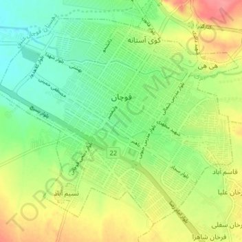
Nom : Carte topographique Ghoochan City, altitude, relief.
Altitude moyenne : 1 324 m
Altitude minimum : 1 292 m
Altitude maximum : 1 367 m
Quchan is in the north-east of Iran in Razavi Khorasan Province at an elevation of 1,149 meters above sea level north of the Shah Jahan Mountains. It is located south of the border with Turkmenistan. Quchan is connected by road to Mashhad, 125 km southeast and Turkmenistan, 100 km north.