
Carte topographique Jahada
Carte interactive
Cliquez sur la carte pour afficher l’altitude.
À propos de cette carte
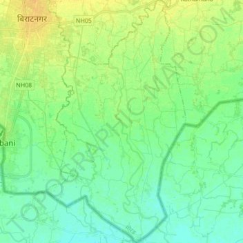
Nom : Carte topographique Jahada, altitude, relief.
Lieu : Jahada, Morang, Koshi Province, Nepal (26.34776 87.28936 26.47140 87.36907)
Altitude moyenne : 65 m
Altitude minimum : 57 m
Altitude maximum : 77 m
Autres cartes topographiques
Cliquez sur une carte pour visualiser sa topographie, son altitude et son relief.
Dhanpalthan
Nepal > Koshi Province > Morang
Dhanpalthan, Morang, Koshi Province, Nepal
Altitude moyenne : 71 m
Pathari
Nepal > Koshi Province > Morang
Pathari, Patahrishanishchare, Morang, Koshi Province, 56600, Nepal
Altitude moyenne : 139 m