
Carte topographique Chandipur
Carte interactive
Cliquez sur la carte pour afficher l’altitude.
À propos de cette carte
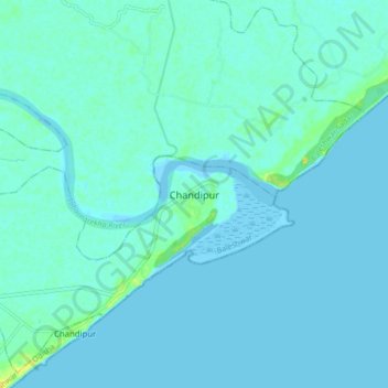
Nom : Carte topographique Chandipur, altitude, relief.
Altitude moyenne : 3 m
Altitude minimum : -2 m
Altitude maximum : 21 m
Chandipur is located at 21°28′N 87°01′E / 21.47°N 87.02°E / 21.47; 87.02. It has an average elevation of 3 m (9.8 ft). This town is 51.330 acres (0.20773 km2) in size. Chandipur beach can be submerged at high tide.