
Carte topographique Camiling
Carte interactive
Cliquez sur la carte pour afficher l’altitude.
À propos de cette carte
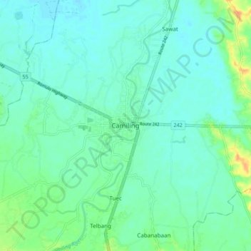
Nom : Carte topographique Camiling, altitude, relief.
Lieu : Camiling, Tarlac, Central Luzon, 2306, Philippines (15.64638 120.37468 15.72638 120.45468)
Altitude moyenne : 19 m
Altitude minimum : 10 m
Altitude maximum : 47 m
Mostly of plain topography but some parts are hilly to mountainous in which the barangays of Papaac, Bacsay, Birbira and Cayasan, to name a few. The deeper part of the mountains can be described as a place where wild animals live, such as deer, Toddy cat (Musang), wild boar (Baboy ramo), Monitor lizard (Bayawak)