
Carte topographique Навобод
Carte interactive
Cliquez sur la carte pour afficher l’altitude.
À propos de cette carte
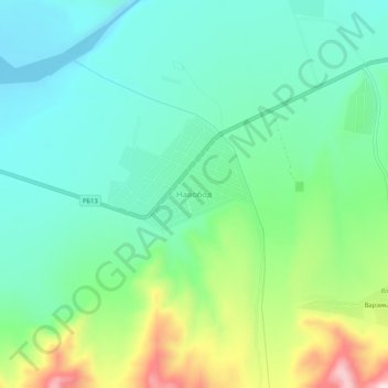
Nom : Carte topographique Навобод, altitude, relief.
Lieu : Навобод, Ноҳияи Панҷакент, Sughd, Tadjikistan (39.42752 67.90237 39.46752 67.94237)
Altitude moyenne : 1 197 m
Altitude minimum : 1 086 m
Altitude maximum : 1 480 m
Autres cartes topographiques
Cliquez sur une carte pour visualiser sa topographie, son altitude et son relief.
Нофин
Tadjikistan > Sughd > Ноҳияи Панҷакент
Нофин, Ноҳияи Панҷакент, Sughd, Tadjikistan
Altitude moyenne : 2 260 m