
Carte topographique Te Whekau Lagoon
Carte interactive
Cliquez sur la carte pour afficher l’altitude.
À propos de cette carte
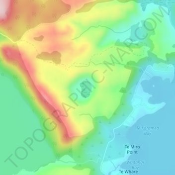
Nom : Carte topographique Te Whekau Lagoon, altitude, relief.
Altitude moyenne : 393 m
Altitude minimum : 298 m
Altitude maximum : 572 m
Autres cartes topographiques
Cliquez sur une carte pour visualiser sa topographie, son altitude et son relief.
Lake Tarawera
New Zealand > Bay of Plenty > Lake Tarawera
Lake Tarawera, Rotorua District, Bay of Plenty, New Zealand
Altitude moyenne : 414 m