
Carte topographique Shoranur
Carte interactive
Cliquez sur la carte pour afficher l’altitude.
À propos de cette carte
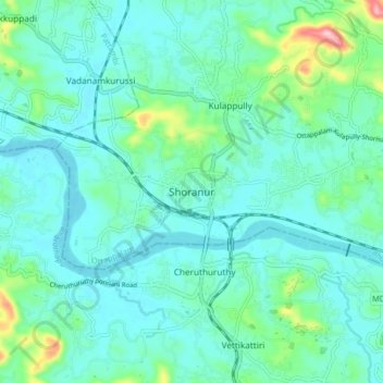
Nom : Carte topographique Shoranur, altitude, relief.
Lieu : Shoranur, Ottappalam, Palakkad district, Kerala, 679121, India (10.72372 76.23236 10.80372 76.31236)
Altitude moyenne : 47 m
Altitude minimum : 12 m
Altitude maximum : 207 m
Shornur is located at 10°46′N 76°17′E / 10.77°N 76.28°E / 10.77; 76.28. It has an average elevation of 49 metres (160 feet).