
Carte topographique Stephenville
Carte interactive
Cliquez sur la carte pour afficher l’altitude.
À propos de cette carte
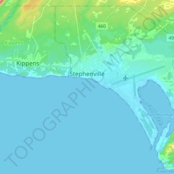
Nom : Carte topographique Stephenville, altitude, relief.
Lieu : Stephenville, Newfoundland and Labrador, Canada (48.49959 -58.61053 48.57782 -58.48415)
Altitude moyenne : 22 m
Altitude minimum : -1 m
Altitude maximum : 214 m