
Carte topographique Somerville Island
Carte interactive
Cliquez sur la carte pour afficher l’altitude.
À propos de cette carte
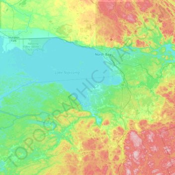
Nom : Carte topographique Somerville Island, altitude, relief.
Altitude moyenne : 277 m
Altitude minimum : 190 m
Altitude maximum : 500 m
Autres cartes topographiques
Cliquez sur une carte pour visualiser sa topographie, son altitude et son relief.
Lonely Island
Canada > Ontario > Nipissing Township
Lonely Island, Nipissing Township, Parry Sound District, Ontario, Canada
Altitude moyenne : 275 m