
Carte topographique Khwazakhela
Carte interactive
Cliquez sur la carte pour afficher l’altitude.
À propos de cette carte
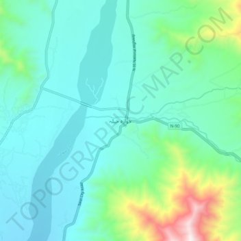
Nom : Carte topographique Khwazakhela, altitude, relief.
Lieu : Khwazakhela, Swāt District, Khyber Pakhtunkhwa, Pakistan (34.89703 72.42694 34.97703 72.50694)
Altitude moyenne : 1 260 m
Altitude minimum : 1 050 m
Altitude maximum : 2 135 m