
Carte topographique L'Ardoise
Carte interactive
Cliquez sur la carte pour afficher l’altitude.
À propos de cette carte
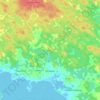
Nom : Carte topographique L'Ardoise, altitude, relief.
Altitude moyenne : 27 m
Altitude minimum : -2 m
Altitude maximum : 75 m
Autres cartes topographiques
Cliquez sur une carte pour visualiser sa topographie, son altitude et son relief.
Fourchu
Canada > Nouvelle-Écosse > Municipality of the County of Richmond
Fourchu, Municipality of the County of Richmond, Richmond County, Nouvelle-Écosse, Canada
Altitude moyenne : 5 m