

Carte topographique Toney
Cliquez sur la carte pour afficher l’altitude.
À propos de cette carte

Nom : Carte topographique Toney, altitude, relief.
Lieu : Toney, Madison County, Alabama, United States (34.87814 -86.75357 34.91814 -86.71357)
Altitude moyenne : 255 m
Altitude minimum : 236 m
Altitude maximum : 271 m
Autres cartes topographiques
Cliquez sur une carte pour visualiser sa topographie, son altitude et son relief.
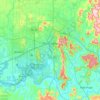
Huntsville
United States > Alabama > Madison County
Huntsville lies in the Tennessee Valley, where broad lowlands meet the western escarpments and outliers of the Cumberland Plateau. The city’s central and western areas occupy relatively flat to gently rolling valley terrain, while the eastern and southeastern skyline rises abruptly toward Monte Sano, Green…
Altitude moyenne : 232 m


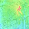


Harvest
United States > Alabama > Madison County > Harvest
Capshaw Mountain (1,250 feet above sea level) is the only notable geological feature in the area, which extends about 800 feet above the general elevation in the area. The top of this small mountain is the site of several substantial communications towers used by local radio stations. Capshaw Mountain forms a…
Altitude moyenne : 254 m
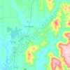
Huntsville
United States > Alabama > Madison County
Huntsville lies in the Tennessee Valley, where broad lowlands meet the western escarpments and outliers of the Cumberland Plateau. The city’s central and western areas occupy relatively flat to gently rolling valley terrain, while the eastern and southeastern skyline rises abruptly toward Monte Sano, Green…
Altitude moyenne : 232 m