
Carte topographique St. Just Islands
Carte interactive
Cliquez sur la carte pour afficher l’altitude.
À propos de cette carte
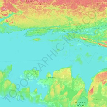
Nom : Carte topographique St. Just Islands, altitude, relief.
Altitude moyenne : 216 m
Altitude minimum : 172 m
Altitude maximum : 412 m
Autres cartes topographiques
Cliquez sur une carte pour visualiser sa topographie, son altitude et son relief.
The Three Sisters
Canada > Ontario > Algoma District > The North Shore Township
The Three Sisters, The North Shore Township, Algoma District, Northeastern Ontario, Ontario, Canada
Altitude moyenne : 241 m
Robin Island
Canada > Ontario > Algoma District > The North Shore Township
Robin Island, The North Shore Township, Algoma District, Northeastern Ontario, Ontario, Canada
Altitude moyenne : 188 m