
Carte topographique Darakeh
Carte interactive
Cliquez sur la carte pour afficher l’altitude.
À propos de cette carte
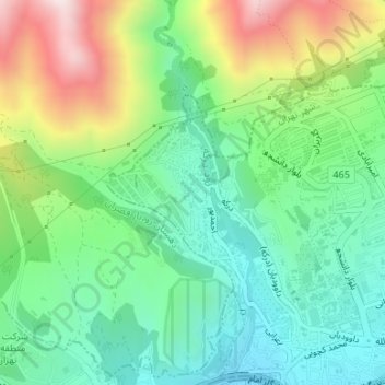
Nom : Carte topographique Darakeh, altitude, relief.
Altitude moyenne : 1 820 m
Altitude minimum : 1 595 m
Altitude maximum : 2 265 m
Autres cartes topographiques
Cliquez sur une carte pour visualiser sa topographie, son altitude et son relief.
Tajrish
Iran > Tehran Province > Tehran
Tajrish, District 1, Tehran, بخش رودبار قصران, Shemiranat County, Tehran Province, Iran
Altitude moyenne : 1 618 m
Chitgar
Iran > Tehran Province > Tehran
Chitgar, District 21, Tehran, بخش مرکزی شهرستان تهران, Tehran County, Tehran Province, 1386183731, Iran
Altitude moyenne : 1 206 m