
Carte topographique Villa Ada
Carte interactive
Cliquez sur la carte pour afficher l’altitude.
À propos de cette carte
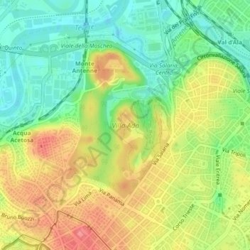
Nom : Carte topographique Villa Ada, altitude, relief.
Lieu : Villa Ada, Municipio Roma II, Rome, RM, Lazio, Italy (41.92277 12.49260 41.94044 12.50911)
Altitude moyenne : 44 m
Altitude minimum : 8 m
Altitude maximum : 84 m
Autres cartes topographiques
Cliquez sur une carte pour visualiser sa topographie, son altitude et son relief.
Municipio Roma II
Municipio Roma II, Rome, RM, Lazio, Italy
Altitude moyenne : 43 m