
Carte topographique Smithville
Carte interactive
Cliquez sur la carte pour afficher l’altitude.
À propos de cette carte
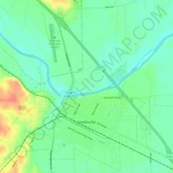
Nom : Carte topographique Smithville, altitude, relief.
Lieu : Smithville, Bastrop County, Texas, 78957, United States (29.99144 -97.17709 30.04010 -97.11988)
Altitude moyenne : 100 m
Altitude minimum : 81 m
Altitude maximum : 139 m
Autres cartes topographiques
Cliquez sur une carte pour visualiser sa topographie, son altitude et son relief.
Tuck Lake
United States > Texas > Bastrop County > Camp Swift
Tuck Lake, Camp Swift, Bastrop County, Texas, United States
Altitude moyenne : 139 m
Smithville
United States > Texas > Bastrop County > Smithville > Smithville
Smithville, Bastrop County, Texas, 78957, United States
Altitude moyenne : 107 m