
Carte topographique Pionki
Carte interactive
Cliquez sur la carte pour afficher l’altitude.
À propos de cette carte
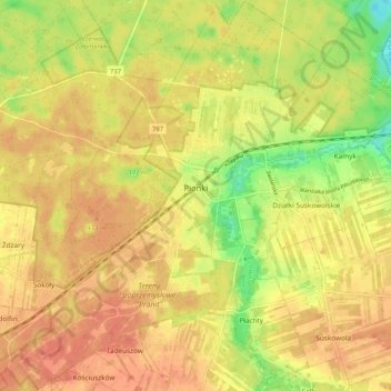
Nom : Carte topographique Pionki, altitude, relief.
Lieu : Pionki, Radom County, Masovian Voivodeship, Poland (51.43943 21.39544 51.50412 21.49964)
Altitude moyenne : 159 m
Altitude minimum : 129 m
Altitude maximum : 175 m
Autres cartes topographiques
Cliquez sur une carte pour visualiser sa topographie, son altitude et son relief.
Iłża
Poland > Masovian Voivodeship > Radom County
Iłża, gmina Iłża, Radom County, Masovian Voivodeship, 27-100, Poland
Altitude moyenne : 204 m
Zatopolice
Poland > Masovian Voivodeship > Radom County > Zatopolice
Zatopolice, gmina Zakrzew, Radom County, Masovian Voivodeship, Poland
Altitude moyenne : 188 m