
Faire un don
Équipez-vous pour votre prochaine aventure :
En tant que Partenaire Amazon, ce site perçoit une commission sur les achats éligibles sans surcoût pour vous.
Carte topographique Lascar
Cliquez sur la carte pour afficher l’altitude.
Faire un don
Équipez-vous pour votre prochaine aventure :
En tant que Partenaire Amazon, ce site perçoit une commission sur les achats éligibles sans surcoût pour vous.
Lascar
Large lava flows are noticeable on the flanks of the volcano, with a total of eight lava flows recognized. They extend from the summit craters, although none of them appear to be associated with the currently active crater. Flows from the first stage of Lascar's activity are exposed at its western foot, while lava flows are buried beneath pyroclastic material on the eastern flank. A 6-kilometre-long (3.7 mi) lava flow on the northern flank reaches almost to the village of Talabre. This lava flow is known as the Tumbres–Talabre lava flow; its margins are 10–40 metres (33–131 ft) high, and it features a central channel. The flow advanced just north of the head of Quebrada Talabre before passing over cliffs and entering it. Another lava flow on the southwest flank is known as the Capricorn Lava. This dacitic lava was erupted on Lascar at high altitude and has a blocky surface. It features well developed levees and a 10-metre-thick (33 ft) flow front. Its rocks have a pale gray-blue colour, and their composition resembles the Soncor flow, despite more mafic lavas and pyroclastics being erupted in the time period between the emplacement of the Soncor flow and the Capricorn Lava.
Faire un don
Équipez-vous pour votre prochaine aventure :
En tant que Partenaire Amazon, ce site perçoit une commission sur les achats éligibles sans surcoût pour vous.
À propos de cette carte
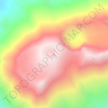
Nom : Carte topographique Lascar, altitude, relief.
Altitude moyenne : 5 269 m
Altitude minimum : 4 711 m
Altitude maximum : 5 600 m
Faire un don
Équipez-vous pour votre prochaine aventure :
En tant que Partenaire Amazon, ce site perçoit une commission sur les achats éligibles sans surcoût pour vous.
Autres cartes topographiques
Cliquez sur une carte pour visualiser sa topographie, son altitude et son relief.
Laguna Lejía
Chile > Antofagasta Region > Provincia de El Loa > San Pedro de Atacama
Lejía Lake is a circular, shallow lake at an elevation of 4,325 metres (14,190 ft) with a surface area of 1.9 square kilometres (0.73 sq mi) or 2 square kilometres (0.77 sq mi). It is a polymictic lake which freezes over occasionally and whose waters are turned over quickly, mainly through evaporation. Winds…
Altitude moyenne : 4 341 m
Atacama Large Millimeter Array Science Preserve
Chile > Antofagasta Region > Provincia de El Loa > San Pedro de Atacama
The Atacama Large Millimeter/submillimeter Array (ALMA) is an astronomical interferometer of 66 radio telescopes in the Atacama Desert of northern Chile, which observe electromagnetic radiation at millimeter and submillimeter wavelengths. The array has been constructed on the 5,000 m (16,000 ft) elevation…
Altitude moyenne : 4 815 m