
Carte topographique Camp Saint Christopher
Carte interactive
Cliquez sur la carte pour afficher l’altitude.
À propos de cette carte
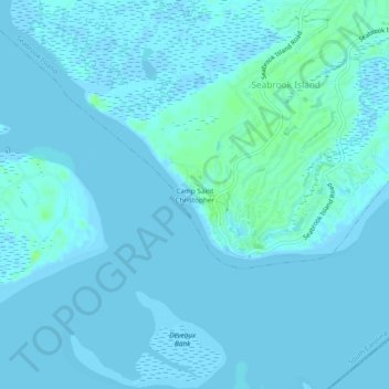
Nom : Carte topographique Camp Saint Christopher, altitude, relief.
Altitude moyenne : 2 m
Altitude minimum : -3 m
Altitude maximum : 10 m
Autres cartes topographiques
Cliquez sur une carte pour visualiser sa topographie, son altitude et son relief.
Seabrook Island
United States > South Carolina > Charleston County > Seabrook Island
Seabrook Island, Charleston County, South Carolina, United States
Altitude moyenne : 2 m