
Carte topographique Lawlor's Strand
Carte interactive
Cliquez sur la carte pour afficher l’altitude.
À propos de cette carte
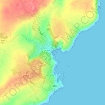
Nom : Carte topographique Lawlor's Strand, altitude, relief.
Lieu : Lawlor's Strand, Dunmore East, Ireland (52.15401 -6.99471 52.15526 -6.99356)
Altitude moyenne : 33 m
Altitude minimum : 0 m
Altitude maximum : 84 m