
Carte topographique Thompson Falls
Carte interactive
Cliquez sur la carte pour afficher l’altitude.
Thompson Falls
Thompson Falls is located in the Clark Fork Valley at an elevation of 2,419 feet (737 m). The Clark Fork River flows on the southern side of town. It is next to the Cabinet Mountains.
À propos de cette carte
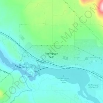
Nom : Carte topographique Thompson Falls, altitude, relief.
Altitude moyenne : 782 m
Altitude minimum : 713 m
Altitude maximum : 1 022 m