
Carte topographique Bhamo District
Carte interactive
Cliquez sur la carte pour afficher l’altitude.
À propos de cette carte
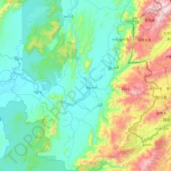
Nom : Carte topographique Bhamo District, altitude, relief.
Lieu : Bhamo District, Kachin, Myanmar (23.63325 96.54904 24.90498 97.76921)
Altitude moyenne : 551 m
Altitude minimum : 89 m
Altitude maximum : 2 633 m
Autres cartes topographiques
Cliquez sur une carte pour visualiser sa topographie, son altitude et son relief.
Putao Township
Myanmar > Kachin > Putao Township > Putao Township
Putao Township, Putao District, Kachin, 01051, Myanmar
Altitude moyenne : 1 555 m
Hkakabo Razi
Myanmar > Kachin > Nawngmun Township
Hkakabo Razi, Nawngmun Township, Putao District, Kachin, Myanmar
Altitude moyenne : 4 869 m