
Carte topographique Duzduzan
Carte interactive
Cliquez sur la carte pour afficher l’altitude.
À propos de cette carte
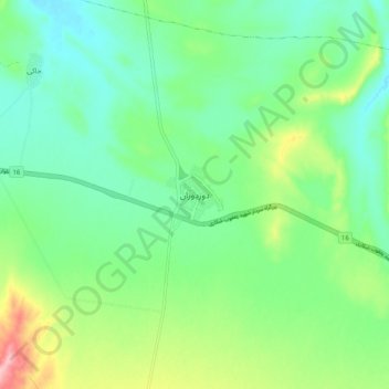
Nom : Carte topographique Duzduzan, altitude, relief.
Altitude moyenne : 1 672 m
Altitude minimum : 1 624 m
Altitude maximum : 1 786 m
Duzduzan is located in the mountains of Arasbaran in north-western Iran on the highway between Ardabil and Tabriz. Although not on the river it is within the drainage basin of the Aji Chay. Because of its high elevation it has a climate that is generally cold and rainy. The city is 15 km by road east of the village of Kurdkandi and 32 km by road east of Bostanabad. Duzduzan is 37 km by road west of the city of Sarab, the county seat.